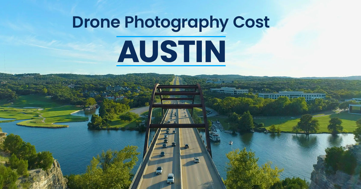
How Much Does Drone Photography Cost in Austin?
Drone photography has become a powerful tool for showcasing properties, construction projects, and infrastructure across Austin. From real estate listings to development marketing, aerial imagery helps people quickly understand the scale, location, and surrounding context of a site in a way that ground-level photos simply can’t.
If you’re considering hiring a drone photographer, one of the first questions you’ll likely ask is: how much does it cost? The answer can vary widely depending on the type of project, the deliverables you need, and the experience level of the pilot or agency you hire.
In this guide, we’ll break down the typical price ranges for drone photography in the Austin area, explain what factors influence the cost, and help you understand the differences between basic aerial photos, cinematic video, and larger commercial or infrastructure projects.
Average Drone Photography Cost in Austin
Drone photography pricing in Austin can vary quite a bit depending on the type of project, the number of deliverables, and the level of experience required. A simple residential real estate shoot is usually far less involved than a commercial video project, recurring construction progress updates, or infrastructure work that requires more planning and coordination.
The ranges below are meant to give a general sense of what clients can typically expect in the Austin market. They are not fixed rates, but broad estimates based on common project types and deliverables.
As you can see, drone photography pricing depends heavily on the scope of the project. In general, still photos are the most affordable option, while edited video, larger commercial sites, and specialized infrastructure work tend to cost more because they require additional flight planning, capture time, editing, and experience.
That’s why it’s usually more helpful to think in terms of project range rather than a single flat price. The sections below break down the main factors that influence cost, so you can better understand what drives pricing from one project to the next.
What Affects Drone Photography Pricing?
Drone photography pricing can vary significantly depending on the scope of the project and the type of deliverables needed. A quick residential real estate shoot is very different from filming a large commercial property, documenting construction progress, or producing a fully edited marketing video. Several factors influence the final cost, and understanding them can help you better estimate what your project may require.
Below are the main elements that typically affect drone photography pricing.
Type of Deliverables – Photos vs Video
One of the biggest pricing factors is whether the project requires still photography, video, or both.
Drone photos are typically faster to capture and edit. A pilot may only need a handful of carefully composed aerial angles to show the property layout, surrounding neighborhood, and key features.
Drone video, on the other hand, usually requires more planning and technical skill. Capturing smooth cinematic footage involves multiple flight paths, controlled movements, and careful framing. After the shoot, the footage also needs to be edited, color corrected, and compiled into a polished video. Because of this additional work, video projects are generally more expensive than photo-only shoots.
Size and Complexity of the Property
The size of the property or site also plays a major role in pricing.
Smaller residential properties can often be captured in a short amount of time with a limited number of shots. Larger properties – such as commercial developments, ranch land, or industrial sites – typically require more flight planning, more images or footage, and additional time on location.
Complex environments may also require extra planning. For example, properties near downtown areas, airports, or dense urban environments may require additional coordination due to airspace restrictions.
Editing and Post-Production
The amount of editing required after the shoot can also impact pricing.
Basic projects may only require light editing, such as color correction and exporting finished photos. More advanced projects may involve:
- compiling multiple video clips into a highlight reel
- adding music and titles
- stabilizing footage
- color grading for a cinematic look
- preparing different versions for social media or marketing materials
The more time spent in post-production, the higher the overall project cost tends to be.
Experience and Skill Level of the Pilot
Drone photography prices can also vary depending on the experience and expertise of the pilot or company you hire.
Some operators may be hobbyists or part-time pilots who offer lower rates but may have limited experience working on commercial projects. Professional drone photographers and agencies typically charge more because they bring:
- consistent image quality
- professional editing workflows
- commercial insurance
- reliable scheduling and communication
For businesses using aerial imagery to market properties or document projects, consistency and reliability are often just as important as the footage itself.
Licensing, Insurance, and Compliance
In the United States, commercial drone work must be performed by a pilot who holds an FAA Part 107 Remote Pilot Certificate. Professional operators also typically carry liability insurance to protect clients and projects.
In some locations, additional steps may be required before flying, such as:
- obtaining airspace authorization
- coordinating with nearby airports
- planning safe flight paths in populated areas
These requirements ensure that drone operations are conducted safely and legally, but they also add to the overall cost of professional services.
Travel and Scheduling
Finally, travel distance and scheduling can influence pricing. Most drone photographers include a standard service area, but projects located farther outside the city or in remote locations may require additional travel time.
Projects that require multiple site visits, recurring flights for construction documentation, or tight scheduling windows may also affect pricing depending on the scope of the work.
While every project is different, these factors are the main reasons drone photography pricing can vary from one shoot to another. Understanding them can help you determine what level of service makes the most sense for your project and what kind of budget to expect.
Drone Photography Costs by Use Case
Drone photography is used across a wide range of industries in Austin, and pricing often reflects the type of project being captured. A small residential listing typically requires fewer images and less time on site than documenting a large commercial property, construction site, or infrastructure project. The intended use of the imagery – whether for marketing, documentation, or inspection – also plays a role in the complexity of the shoot.
Below are some of the most common use cases for drone photography and the typical price ranges associated with each.

Residential Real Estate
$150 – $500
(for shoot + photos & editing)
For residential real estate listings, drone photography is often used to show the overall layout of the property, nearby amenities, and surrounding neighborhood. Aerial images help potential buyers understand the context of the home – such as lot size, proximity to parks or water, and how the property sits within the area.
These shoots are usually relatively quick and straightforward, often requiring only a handful of carefully composed aerial photos. Because of this, residential real estate drone photography is typically one of the more affordable options.
Deliverables often include several high-resolution aerial photos suitable for MLS listings, marketing materials, and real estate websites.

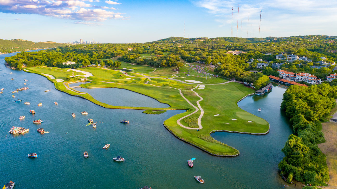
Commercial Real Estate
$400 – $2,000+
(for shoot + photos & editing)
Commercial real estate projects are often larger and more complex than residential listings. Office buildings, retail centers, industrial properties, and multifamily developments typically require more extensive coverage to properly show the scale of the property and its location within the surrounding area.
In addition to aerial photos, these projects may also include drone video to help illustrate traffic flow, building access, parking areas, and nearby infrastructure.
Because of the larger scale and additional deliverables, commercial real estate drone shoots tend to fall into a higher price range.
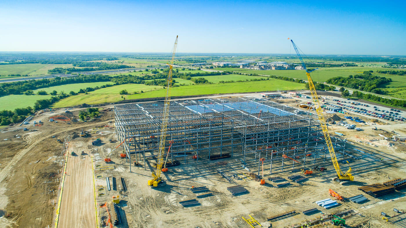
Construction and Development Projects
$400 – $2,000+ per shoot
(or ongoing pricing for recurring photo documentation)
Drone photography is widely used in the construction industry to document project progress, provide visual updates to stakeholders, and capture marketing material for new developments.
Many construction projects involve recurring drone flights at different stages of the build. These images and videos help track progress, monitor site conditions, and create visual timelines of the project.
Because these shoots often require ongoing coordination, larger sites, and repeat visits, pricing can vary depending on how frequently the flights occur and the level of documentation needed.
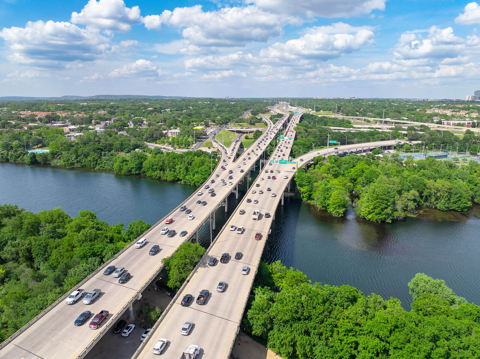
Infrastructure and Industrial Projects
$600 – $4,000+
(depending on the scope of the project)
Infrastructure and industrial drone work typically involves projects such as highways, bridges, utilities, large industrial facilities, or engineering documentation. These environments often require additional safety considerations, careful planning, and a higher level of experience operating drones in complex environments.
These projects may also involve capturing detailed imagery for engineering teams, inspections, or large-scale documentation.
Because of the increased complexity and responsibility involved, infrastructure and industrial drone photography generally falls at the higher end of the pricing spectrum.
While these ranges provide a general sense of what drone photography may cost for different types of projects, the final price always depends on the specific requirements of the shoot. Factors such as the size of the location, the number of deliverables, and the level of editing involved can all influence the final project cost.
Cheap Drone Hobbyists vs Professional Operators
If you search for drone photography services in Austin, you’ll likely find a wide range of prices. Some listings may advertise aerial photos for well under $100, while established professional operators charge several hundred dollars or more depending on the project. The difference usually comes down to experience, reliability, and the level of service being provided.
While budget options can sometimes work for very simple projects, it’s helpful to understand what typically separates lower-cost drone services from professional operators.
Hobbyists and Entry-Level Drone Pilots
Many people who own drones enjoy flying recreationally and may occasionally offer photography services on the side. These pilots often charge lower rates because they are still building experience or treating drone work as a part-time activity.
For small or informal projects, this can sometimes be a reasonable option. However, hobbyist operators may have limitations when it comes to consistency, editing, or working on more complex commercial projects. They may also have limited experience with things like coordinating airspace authorization, managing lighting conditions, or capturing footage specifically designed for marketing and professional use.
In some cases, hobbyists may also lack commercial liability insurance or a consistent workflow for delivering finished images and videos.
Freelance Drone Photographers
Freelance drone photographers typically fall somewhere in the middle of the price spectrum. Many freelancers are experienced pilots who regularly work with real estate agents, small businesses, and property owners.
These operators often provide good quality images and basic editing at reasonable rates. For standard projects such as residential listings or simple aerial photography, freelance professionals can be a solid option.
However, the level of service may vary depending on the individual operator. Turnaround times, editing style, and reliability can differ from one freelancer to another.
Professional Drone Photography Companies
Professional drone photography companies and agencies generally operate at the higher end of the pricing range. In return, they provide a more structured and consistent service.
Professional operators typically bring several advantages, including:
- FAA Part 107 certification and regulatory compliance
- commercial liability insurance
- consistent image quality and editing standards
- reliable scheduling and communication
- experience working with commercial clients and larger projects
For industries such as commercial real estate, construction, and infrastructure, these factors are often important because the imagery is being used for marketing, documentation, or stakeholder communication.
Why Experience Matters
Drone photography involves more than simply launching a drone and taking pictures from the air. Capturing high-quality aerial imagery requires an understanding of composition, lighting, flight planning, and safe operation in different environments. This is especially true when it comes to videography, which not only requires more technical photography knowledge to adjust for ISO, shutter speed, and aperture to prevent rolling shutter, but the skill of the pilot also makes a huge difference between a buttery smooth professional video and a jerky unwatchable one.
Experienced operators also know how to position the drone to highlight the most important aspects of a property or project. This can make a significant difference in how effective the final images or videos are for marketing and communication. A professional company is also going to be much more experienced in post-production editing, which is a very different skill and knowledge-base than piloting a drone – and matters just as much for the quality of the finished photos & videos.
For businesses relying on aerial imagery to showcase a property or document a project, working with a skilled and reliable operator often leads to better results than simply choosing the lowest-cost option.
Finding the Right Balance
Ultimately, the best choice depends on the needs of the project. For a simple aerial snapshot of your personal home or project, a lower-cost option may be sufficient. For more complex work – such as commercial real estate marketing, development documentation, or infrastructure projects – many clients prefer the reliability and expertise that come with professional operators.
When evaluating drone photography services, it’s usually helpful to review the operator’s portfolio, confirm that they are properly licensed and insured, and ensure that their style and experience match the goals of your project.
National Drone Companies vs Local Pilots
When searching online for drone photography services, many of the companies that appear in search results are actually national drone networks rather than local operators. These companies market themselves as full-service drone providers across the country, but they typically do not employ pilots directly in every city.
Instead, many of these platforms operate by subcontracting projects to whichever independent pilot happens to be available in the area at the time. While this model allows them to offer nationwide coverage, it can sometimes lead to inconsistent results. The pilot assigned to the project may have varying levels of experience, different equipment, or a shooting style that doesn’t always match the expectations of the client.
Tip: You can usually spot this by looking on the company's site for their address or service area (we're based here in Austin).
Working with a local drone photographer or agency often provides a more direct and consistent experience. Local operators are familiar with the area, understand common airspace restrictions, and can plan shoots with Austin’s weather, lighting conditions, and locations in mind. Communication is also typically more straightforward, since clients are working directly with the person or team responsible for capturing and editing the imagery.
There is also something to be said for supporting local businesses and professionals. Austin has a growing community of skilled drone pilots, photographers, and videographers who live and work here in Central Texas. Hiring locally helps support those professionals while building relationships with people who are invested in the same community and market as their clients.
For many projects – especially those involving real estate, construction, or ongoing documentation – working with a trusted local operator can provide a level of reliability and consistency that is harder to achieve through large national networks.
If you’re planning a project in Austin, feel free to reach out. When you contact Volare, you’ll speak directly with the owner here in Austin who can help plan the shoot and answer any questions about your project.
When Drone Photography Is Worth the Cost
Drone photography can add significant value to a project, but it isn’t necessary for every situation. The biggest advantage of aerial imagery is its ability to provide context and scale – showing how a property or project fits within its surroundings in a way that ground-level photos cannot.
For many real estate listings, especially larger properties or homes with unique surroundings, aerial photos help potential buyers quickly understand the layout of the land, nearby features, and overall setting. Properties with acreage, waterfront access, scenic views, or large outdoor amenities often benefit the most from drone imagery because these features are difficult to fully capture from the ground.

Drone photography is also widely used in commercial real estate and development projects, where location and accessibility play an important role. Aerial views can highlight nearby highways, surrounding businesses, parking layouts, and the scale of a property relative to its surroundings. This type of imagery can make marketing materials such as offering memorandums and listing presentations much more informative and visually compelling.
In industries like construction, infrastructure, and engineering, drone imagery can also serve practical purposes beyond marketing. Aerial photos and videos are often used to document project progress, provide updates to stakeholders, and capture an overall view of large sites that would be difficult to observe from the ground.
Ultimately, drone photography tends to be most valuable when the size, location, or layout of a property or project is an important part of the story. When used strategically, aerial imagery can provide clarity, visual impact, and perspective that traditional photography alone cannot offer.
How to Vet a Drone Photographer?
If you’re planning to hire a drone photographer, it’s worth taking a few minutes to evaluate the operator before booking a shoot. While many people own drones today, professional aerial photography requires more than simply flying a drone and taking pictures. Experience, licensing, safety practices, and editing quality can all have a big impact on the final results.

- One of the first things to confirm is that the pilot holds an FAA Part 107 Remote Pilot Certificate. In the United States, this certification is required for commercial drone work. A licensed pilot has demonstrated knowledge of airspace rules, safety procedures, and proper drone operation. This helps ensure that the flight is conducted legally and responsibly.
- It’s also a good idea to ask whether the operator carries commercial liability insurance. Professional drone photographers typically maintain insurance coverage to protect both the client and the operator in the unlikely event of an incident during the shoot. For commercial real estate, construction, and infrastructure projects, insurance is often required by the property owner or project manager.
- Next, review the photographer’s portfolio and editing style. Drone photography is both a technical skill and a visual craft. Look for examples that show clear composition, good lighting, smooth non-jerky video movement, and consistent editing. A strong portfolio can give you a good sense of whether the photographer’s style aligns with what you’re hoping to achieve.
- You may also want to ask about deliverables and turnaround time. Some photographers provide only raw aerial images, while others include color correction, edited video, or additional formats for marketing and social media. Understanding what is included in the final delivery can help avoid surprises later.
- Finally, communication and reliability matter. A professional drone photographer should be able to answer questions about the shoot, explain the process, and coordinate details such as location, timing, and any airspace considerations.
For clients in the Austin area, Volare Videography meets these professional standards, including FAA Part 107 certification, commercial insurance, and experience working with real estate, development, and infrastructure projects. If you have questions about a project, we’re always happy to talk through the details and help determine the best approach!
Frequently Asked Questions
How much does drone photography cost in Austin?
Why is drone video more expensive than drone photos?
Do drone photographers need a license?
Do drone photographers need insurance?
When is drone photography worth using for a property?
Should I hire a local drone photographer or a national drone service?
Looking for a Drone Pilot in Austin?
Whether you need aerial footage, ground photography, or full project coverage, we’re here to help. Let’s bring your vision to life!
(512) 956-8656
info@volare.video